SUMMARY
This is AI generated summarization, which may have errors. For context, always refer to the full article.
What’s the weather like in your area? Report the situation through Rappler’s Agos or tweet us at @rapplerdotcom.
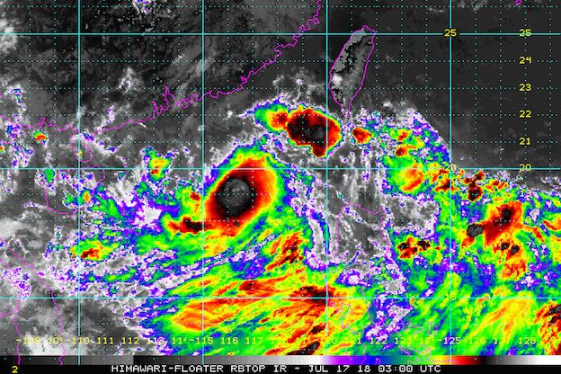
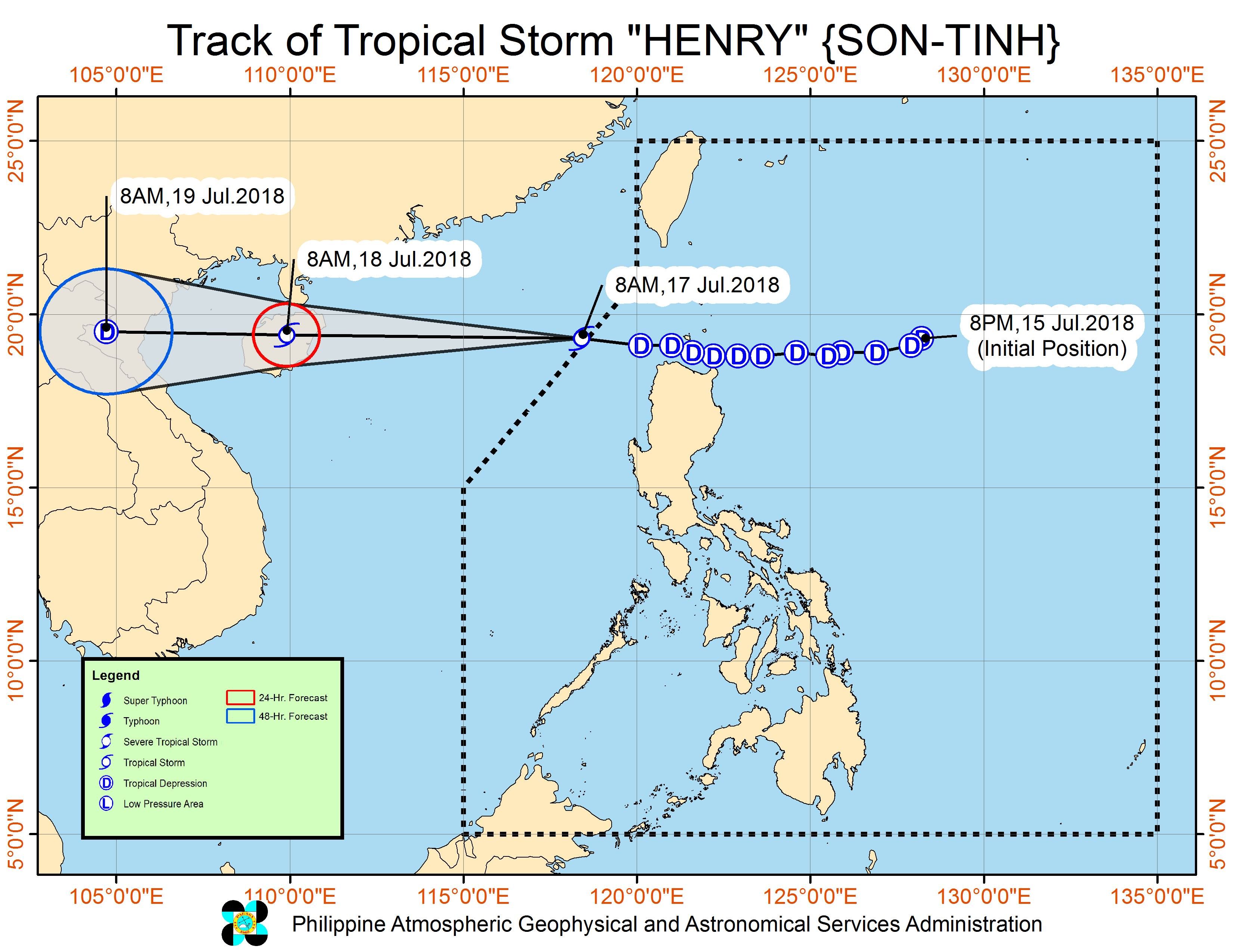
MANILA, Philippines – Tropical Depression Henry intensified into a tropical storm and accelerated as it left the Philippine Area of Responsibility (PAR) on Tuesday morning, July 17. It has been given the international name Son-Tinh.
In a bulletin issued 11 am on Tuesday, state weather bureau PAGASA said Tropical Storm Henry is already 415 kilometers west of Calayan, Cagayan, moving west at a much faster 45 kilometers per hour (km/h) from the previous 25 km/h.
Henry now has maximum winds of 65 km/h from the previous 60 km/h and gustiness of up to 80 km/h from the previous 75 km/h.
There are no more areas under tropical cyclone warning signals.
Henry, the Philippines’ 8th tropical cyclone for 2018, earlier made landfall in the following areas in the province of Cagayan:
- Camiguin Island
- Fuga Island
- Dalupiri Island
Though the tropical storm is already out of PAR, the southwest monsoon or hanging habagat is still bringing rain.
There’s monsoon rain in Metro Manila, Zambales, Bataan, Cavite, Batangas, Oriental Mindoro, Occidental Mindoro, Palawan, and Western Visayas.
Scattered rainshowers and thunderstorms are also being experienced in the rest of the country due to the southwest monsoon.
Flooding has already been reported in several areas. Residents are advised to stay on alert for flash floods and landslides. (READ: FAST FACTS: Tropical cyclones, rainfall advisories)
Various cities and provinces suspended classes for Tuesday due to the heavy rain and floods. (READ: #WalangPasok: Class suspensions, Tuesday, July 17)
After all the cities in Metro Manila had separately declared class suspensions, Malacañang also declared it was suspending classes in Metro Manila beginning 1 pm.
The Palace order also included the suspension of work in government offices in Metro Manila, except for those involved in the delivery of basic and health services, disaster preparedness and management, and other vital functions.
The Senate canceled work too, as ordered by Senator Gregorio Honasan II, who is the officer-in-charge as Senate President Vicente Sotto III is abroad.
The Supreme Court (SC), meanwhile, suspended work for its personnel starting noon. The SC said “discretion is given to presiding justices of third level courts and executive judges of trial courts in Metro Manila and other affected areas to suspend work, considering specific circumstances in their localities.”
The Commission on Elections (Comelec) also suspended work starting noon for its main office in Intramuros, as well as field offices in Metro Manila, Calabarzon, Mimaropa, Bataan, and Bulacan. Voter registration in those areas is also suspended.
PAGASA also warned that sea travel remains risky in the western seaboard of Southern Luzon.
Aside from the southwest monsoon, PAGASA is also monitoring a low pressure area (LPA) located 915 kilometers east of Aparri, Cagayan.
This LPA is still too far to affect the country, but it could develop into a tropical depression within the next 36 hours. If it does, it would be locally named Inday.
The Philippines usually gets an average of 20 tropical cyclones per year. (READ: LIST: PAGASA’s names for tropical cyclones in 2018)
PAGASA declared the start of the rainy season last June 8. – Rappler.com
Add a comment
How does this make you feel?
There are no comments yet. Add your comment to start the conversation.