SUMMARY
This is AI generated summarization, which may have errors. For context, always refer to the full article.
What’s the weather like in your area? Tweet us at @rapplerdotcom.
MANILA, Philippines – Signal No. 1 was raised in two areas on Tuesday afternoon, November 12, due to Tropical Depression Ramon, which slowed down.
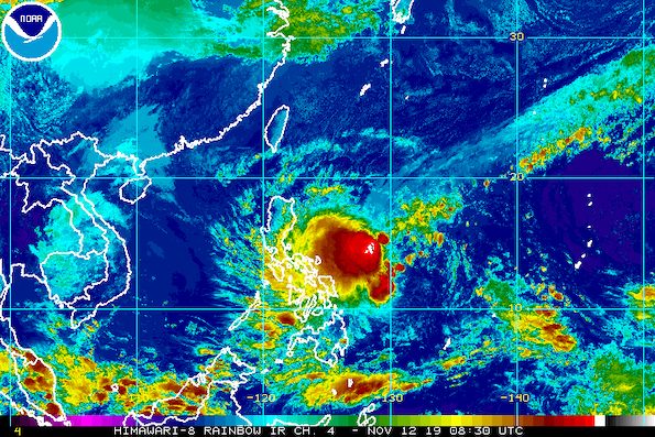
In a briefing past 5 pm on Tuesday, the Philippine Atmospheric, Geophysical, and Astronomical Services Administration (PAGASA) said Ramon is now 670 kilometers east of Borongan City, Eastern Samar.
The tropical depression is still moving west, but even slower than its earlier pace of 10 kilometers per hour (km/h).
Ramon continues to have maximum winds of 55 km/h and gustiness of up to 70 km/h. It is expected to intensify into a tropical storm within the next 48 hours.
Signal No. 1 is now raised in:
- Eastern Samar
- eastern part of Northern Samar
Signal No. 1 means winds of 30 km/h to 60 km/h are expected within 36 hours. Residents are advised to prepare ahead of time. (READ: FAST FACTS: Tropical cyclones, rainfall advisories)
Ramon will also trigger rain in the coming days. Here is the latest on the areas which will be affected:
Wednesday, November 13
- Light to moderate rain with occasionally heavy rain
- Bicol
- Northern Samar
- Samar
- Eastern Samar
- Light to moderate rain with intermittent heavy rain
- Romblon
- Marinduque
- southern part of Quezon
Thursday, November 14
- Light to moderate rain with occasionally heavy rain
- Isabela
- Aurora
- Quirino
- northern part of Quezon, including Polillo Island
- Camarines Norte
- Light to moderate rain with intermittent heavy rain
- Cagayan
- Nueva Vizcaya
- Romblon
- Marinduque
- rest of Bicol
- rest of Quezon
PAGASA warned that flash floods and landslides are possible in areas in Ramon’s path.
Travel is also risky, especially for small vessels, in the seaboards of areas under Signal No. 1, as well as the seaboards of Northern Luzon and the eastern seaboards of Central Luzon, Southern Luzon, and the Visayas.
Based on Ramon’s latest forecast track, it could make landfall in the Isabela-Aurora area on Saturday, November 16. This is possible if the tropical depression maintains its current speed and direction.
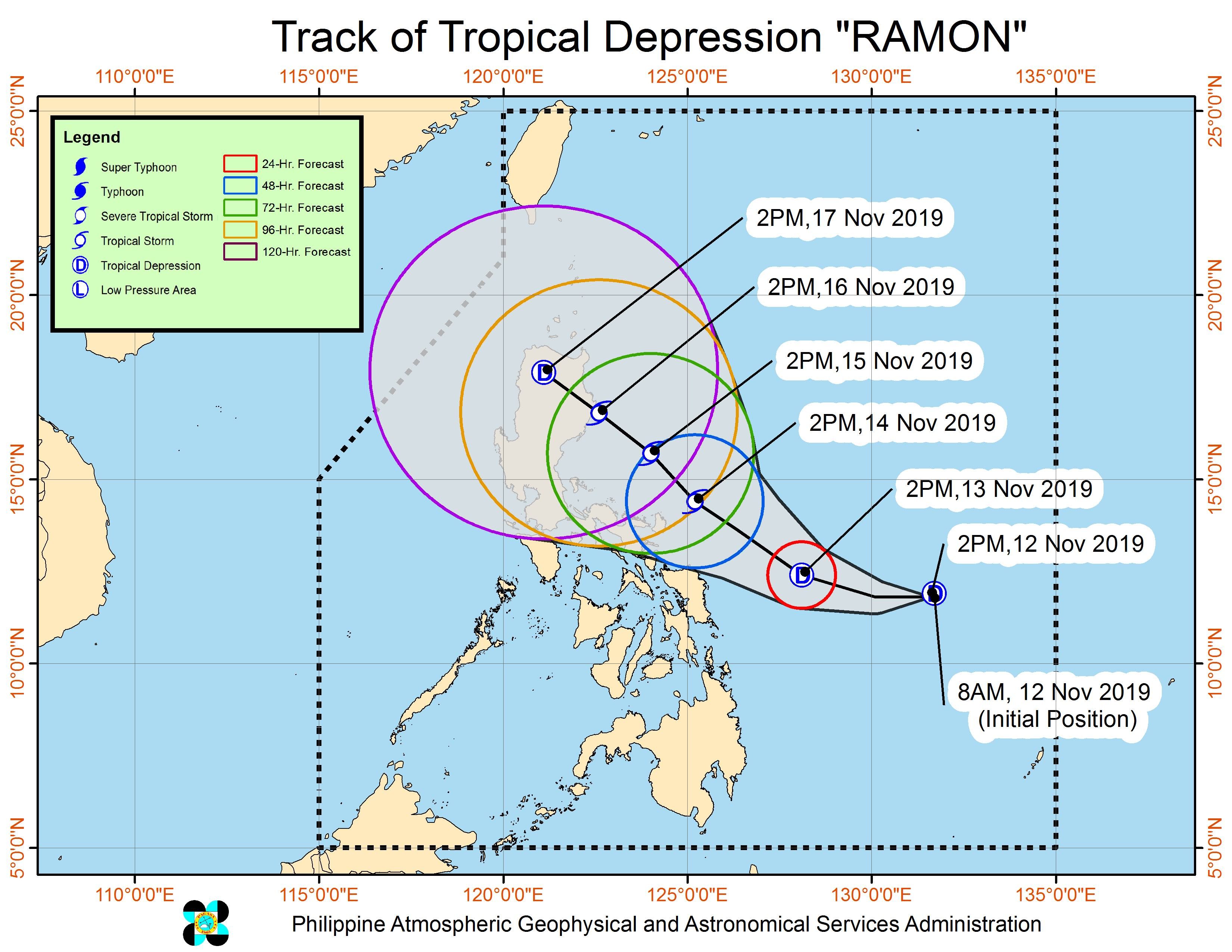
Ramon is the Philippines’ 18th tropical cyclone for 2019, and the 2nd for November. (READ: LIST: PAGASA’s names for tropical cyclones in 2019)
The country gets an average of 20 tropical cyclones annually, but since 2019 is an El Niño year, only 14 to 18 tropical cyclones are expected.
Below is the estimated number of tropical cyclones for the last two months of 2019:
- November – 1 or 2
- December – 0 or 1
PAGASA declared the start of the rainy season last June 14. – Rappler.com
Add a comment
How does this make you feel?
There are no comments yet. Add your comment to start the conversation.