SUMMARY
This is AI generated summarization, which may have errors. For context, always refer to the full article.
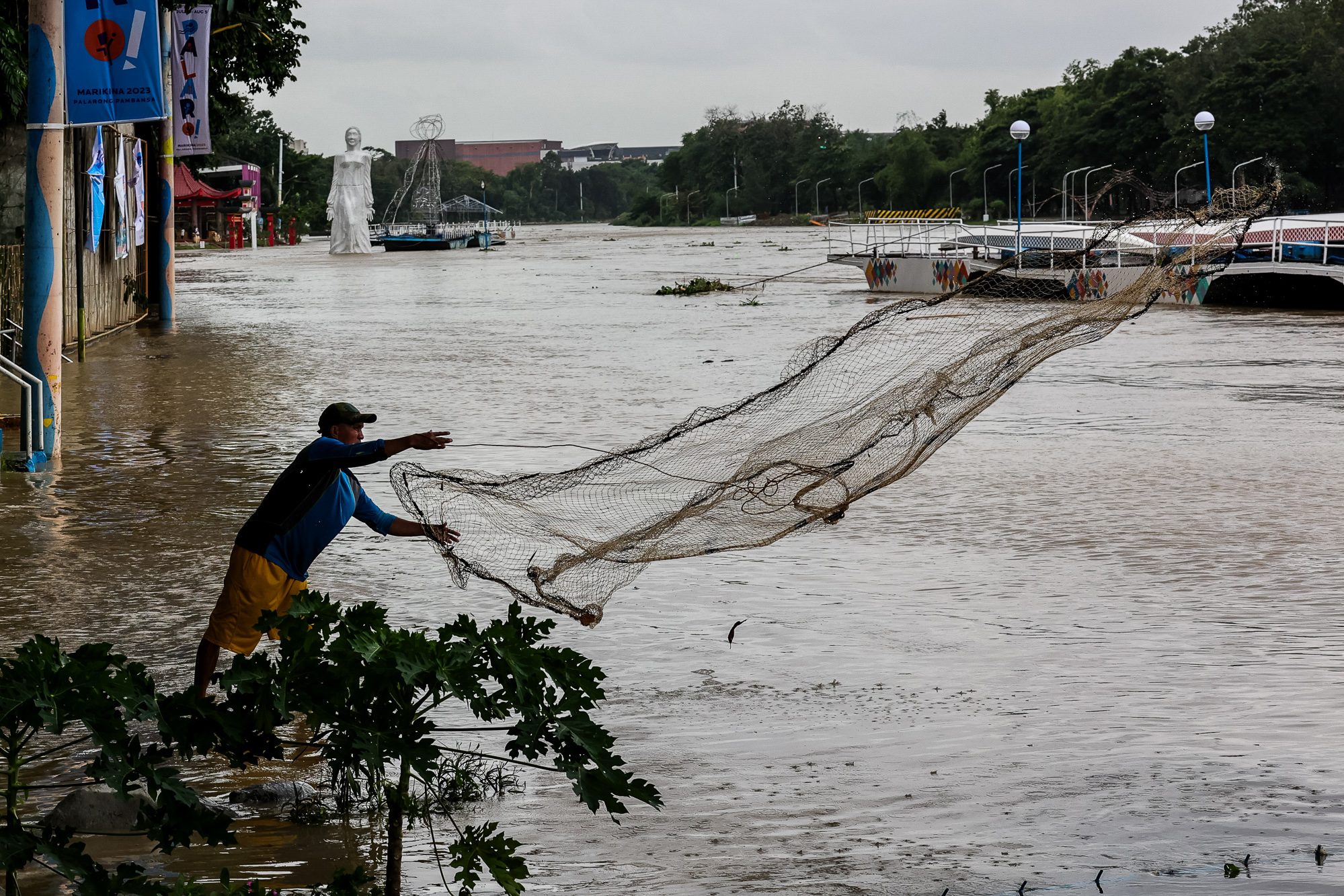
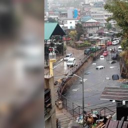
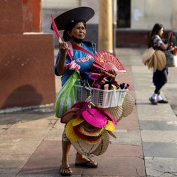
The Philippines can expect more storms in the latter half of this year due to La Niña, according to state weather forecasters. For several areas in Metro Manila, a heavy downpour means there will be floods.
In the Philippines’ densest region, analysis of government data showed that barely one in 100 evacuation facilities are permanent shelters. At least 60 in every 100 of Metro Manila’s “evacuation centers” are schools and basketball courts.
Rappler mapped the evacuation centers in the capital region and looked at the facilities’ and people’s exposure to floods. In our months-long investigation, we found that one-fifth of Metro Manila’s land area are high-risk flood zones. Several evacuation centers are built in these areas and there is not enough space for the surrounding community.
According to a disaster resilience expert, the Philippines has made significant strides since strong typhoons battered the country in recent decades. But Metro Manila still has a long way to go.
Marikina, the hardest hit by storms in Metro Manila
In the past three decades, nearly 107,000 Filipinos in Metro Manila have been affected by typhoons each year. Among cities in the metro, Marikina City has always been the hardest hit, where nine in 100,000 Metro Manila residents have died from typhoons since 2003.
Flooding is a fact of life in Marikina City. Essentially a catch basin, it lies in the Marikina Valley, bound by the Sierra Madre mountain range to the east and the hills of Quezon City to the west. The Marikina River cuts through the western portion of the city.
The Torres family lived near the Marikina River for as long as they can remember. Arlene, 33, and Reizan, 31, grew up in houses apart from each other when they were young. When they got married, Reizan moved into his wife’s house.
Just like the Torreses, their home has endured tough times. Repeated flooding has stained the wall and left a musty smell inside. From blue and green walls, they have since repainted them to white.

Of all the typhoons she has lived through, Arlene said Typhoon Ondoy (Ketsana) in 2009 and Typhoon Ulysses (Vamco) in 2020 were the ones she could not forget.
“I remember it very well. It was on September 26, [2009],” she said. Within six hours from landfall, Ondoy brought a deluge of rain equivalent to a month’s volume in the country.
Arlene, a high school student at the time, was left stranded at her school due to Ondoy’s downpour. She said the students were asked to go home because the flood had been rising, but they were unable to leave the premises.
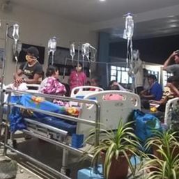
“It was my older sister who rushed home. The water was already so high that she had to use a boat to reach our parents. They made a hole in the roof on the second floor of our house to avoid the flood,” Arlene recalled.

“We laid our father on a table to prevent him from getting wet again,” she said. But because of runoffs from the mountains and the trash that blocked access to roads, we could not get anyone to bring him [to the hospital]. He was cold and was coughing up blood. Days later, when we finally arrived at the hospital, he was declared ‘dead on arrival.’”
Ondoy was the deadliest typhoon that Metro Manila had faced in recent decades, Office of Civil Defense (OCD) data showed. At least 464 people were killed due to the onslaught of the typhoon, and more than half of them were from Metro Manila.
For many Filipinos, Ondoy was a turning point. It exposed Metro Manila’s vulnerabilities and lack of preparedness. A year later, lawmakers passed Republic Act No. 10121 or the Philippine Disaster Risk Reduction and Management Act of 2010.
Majority of Manileños at high risk of floods
The Torreses are among millions of Filipinos who face the risk of having their homes flooded during typhoons or heavy downpours. According to government data, at least eight in 10 Manileños live in flood zones.
More than a decade since Ondoy, Arlene and Reizan still live in the same house where the latter survived the deadly typhoon.
Having lived through strong storms, the Torreses knew what they had to do when Ulysses made landfall – get all the essential items and documents, prepare for evacuation when the Marikina River reaches 15 meters above sea level, and move their appliances and furniture to the second floor.
Living near the river, Reizan had to regularly monitor the updates on the city government’s social media feeds during Ulysses. He knew that once the river’s water level rose to 15 to 16 meters, his wife and children had to evacuate to his in-laws.
So they did. Arlene and the children went to her sister’s house but Reizan was left at home to guard their belongings. Then, the flood reached the second floor. Reizan said he was fortunate that rescuers went to their area.

“When the water reached the second floor, the refrigerator was knocked over. I lost the will to guard our things. There was no use in staying. I just left,” he recalled.
Ulysses made landfall in the middle of the pandemic, in November 2020, packing maximum sustained winds of 150 kilometer per hour (kph) and gustiness of up to 205 kph as it crossed Central Luzon.
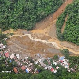
During Ulysses, the Marikina River’s water level rose to 22 meters, breaching Ondoy’s record of 21.5 meters. While Ondoy brought more rain than Ulysses, PAGASA noted that it was possible that Sierra Madre was unable to absorb them – three storms had hit the country within three weeks before Ulysses – resulting in a runoff.
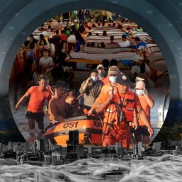
According to UN OCHA [United Nations for the Coordination of Humanitarian Affairs],, over 40,000 houses in Marikina were partially and fully submerged under flood water. All evacuation centers were packed, leaving residents to seek temporary shelter in the homes of their families and friends.
Evacuation centers are at risk of flooding
Evacuation centers are supposed to provide refuge from disasters. However, not all evacuation centers in Metro Manila are located in safe areas. They are not enough for everyone.
Analysis of the data from government hazard portal HazardHunterPH showed that one-fifth of Metro Manila’s land area is at high or very high risk of floods.
Among cities in Metro Manila, Navotas will be the most affected when flooding hits. About two-thirds of Navotas’ land area will be submerged by floods, while half of Malabon, Marikina, and Pasig will be swamped with water.
Latest shelter data from OCD and the Department of the Interior and Local Government showed that over 1,300 evacuation centers were listed as evacuation centers in the capital region. Rappler mapped these facilities to see which of them are in high- and very high-risk flood zones.
Areas with a high risk of flooding may be under one to two meters of water for over three days, according to the environment department’s Mines and Geosciences Bureau, one of the government offices involved in the creation of HazardHunterPH. For an average Filipino, this depth is already waist- to chest-deep.
Those with a very high flood risk may face over two meters of flooding. This height is taller than the average Filipino.
According to our analysis, one in five evacuation centers in the metro are built in high-risk areas. Several of them are in Quezon City, Valenzuela, and Pasig.
Aside from the risk, the designated evacuation centers in the metro could not possibly cater to every resident.
Small cities San Juan and Navotas have the lowest evacuation center-to-population ratio in Metro Manila. San Juan has one evacuation center for every 2,200 residents, while Navotas has one for every 5,600 residents.
In the capital Manila, only two evacuation centers were in official government lists for a population of over 1.8 million people. According to OCD, the Delpan and Baseco evacuation centers can fit 3,700 people. (To be concluded) – Rappler.com
NEXT: La Niña: What ought to be done to be better prepared
*$1 = P56.60
All quotes were translated into English.
Vianca Jasmin Anglo is a data analyst pursuing a postgraduate degree in Human Development and Services. She was part of the public health, pandemic management, and response in the Philippines. Her years of experience in social development demonstrate her commitment to human well-being through data analysis.
Reporting for this story was supported by the Environmental Data Journalism Academy – a program of Internews’ Earth Journalism Network and Thibi.
METHODOLOGY
This data story examined the link between evacuation centers and flood risk in Metro Manila. We obtained the latest evacuation center data from the DILG – which appeared incomplete – and supplemented it with 2021 data from the OCD. Capacity information from these lists are incomplete, limiting our analysis to the evacuation center-to-population ratio.
Using spatial software and Google Sheets, spatial analysis was conducted to pinpoint the intersection between evacuation centers and their corresponding flood susceptibility category from HazardHunterPH. For the full description of our methodology, please read it here. Data cleaning and analysis can be accessed here. This story was a result of collaboration between the author, and the data and story mentors from Thibi, Thet Win Htut, and Aika Rey, respectively.
Add a comment
How does this make you feel?
![[In This Economy] El Niño-nomics: How intense heat is drying up the Philippine economy](https://www.rappler.com/tachyon/2024/05/TL-El-nino-nomics-May-3-2024.jpg?resize=257%2C257&crop=264px%2C0px%2C720px%2C720px)
![[OPINION] Demystifying net-zero and climate reporting in the Philippines](https://www.rappler.com/tachyon/2024/05/TL-climate-reporting-philippines-May-3-2024.jpg?resize=257%2C257&crop_strategy=attention)

There are no comments yet. Add your comment to start the conversation.