SUMMARY
This is AI generated summarization, which may have errors. For context, always refer to the full article.
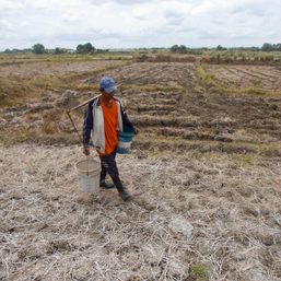
![[OPINION] A tale of two earthquake provinces](https://www.rappler.com/tachyon/2022/08/TL-Abra-Masbate-earthquake.jpg)
For two weeks, I shuttled between two earthquake provinces: Masbate and Abra. These two places are prone to earthquakes since they are both transected by the dreaded active Philippine Fault, generator of several of the more devastating earthquakes the country has experienced in the last 50 years.
The Philippine Fault and devastating earthquakes
It is not the fault of the Philippines, but rather the Philippine Fault. Geologists define this structure as a throughgoing crack that penetrates deep into the Philippine crust, that runs for over 1,200 kilometers from northern Luzon in the town of Bangui, Ilocos Norte, all the way to the town of Mati in Davao Oriental in the south. Along its path, the fault traverses from the north the Cordillera Mountains, the Sierra Madre Mountains, Bondoc Peninsula, then crosses offshore in Ragay Gulf and Ticao Pass in Bicol, and jumps to the islands of Masbate and Leyte before heading back on land in Surigao in eastern Mindanao.
In the last 50 years, several segments of the fault have generated devastating earthquakes, such as the magnitude 7.3 earthquake of Ragay Gulf of March 1973, and the magnitude 7.8 Luzon earthquake of July, 1990 – by far the strongest instrumentally recorded inland earthquake in the Philippines. (TIMELINE: Most destructive earthquakes to hit the Philippines since 1990)
More recently, the Masbate segment ruptured in March 2003, and August 2020, producing earthquakes with magnitudes 6.3 and 6.6 respectively. In 2017, the Surigao (February, magnitude 6.7) and Leyte (July, magnitude 6.5) segments moved independently within several months of each other. All of these Philippine Fault related earthquakes resulted to numerous deaths and costly infrastructure damage.
Masbate and Abra: similar but different
On the 23rd of July, 2022, my class of around 75 individuals composed of incoming senior students and teachers set out early from UP Diliman to travel to Pio Duran, Albay, all in seven vehicles, to catch the midnight RoRo ship to ferry us to Masbate Island the next day.
The class was to undertake two weeks of fieldwork to fulfill the requirements of the degree of BS Geology. Part of the area that the students needed to investigate is a coconut plantation in the mountain village of Matugnao (meaning “cold” in Visayan) in Palanas town, on the southeastern sector of the island, where a lone coconut tree has been snapped by a segment of the Masbate section of the Philippine Fault that ruptured twice in a span of only 17 years (2003 and 2020), an extremely rare phenomenon in earthquake dynamics.
I left the field team momentarily on the 27th of July to attend in-person graduation rites in UP Diliman, the first time the university was holding such exercises since the pandemic struck two-and-a-half years ago. But as I was about to board my flight at the Masbate airport, at around 8:45 in the morning, my earthquake alert app sounded off for a tremor somewhere in Luzon.
Soon thereafter, I started receiving messages from different chat groups of the tremor being felt in various places in Luzon, including in Metro Manila. So instead of attending the graduation rites, I hurried to Abra the next day as a one-man lead group of a university Quick Response Team (QRT) to perform an initial assessment of the ground deformation caused and infrastructure damage wrought by the earthquake.
Like the geologic structure that snapped the coconut tree in Masbate, I was expecting to find a ground rupture associated to the earthquake, especially that the energy released by the magnitude 7 Abra earthquake is about eight times larger than that released by the magnitude 6.6 Masbate earthquake of 2020 (the Richter scale of earthquake magnitudes is logarithmic). But alas, after three days of searching and up to this day, more than two weeks after the earthquake, the ground rupture has not been found (yet).
Masbate and Abra are similar, but different at the same time. Both are similarly transected by segments of the Philippine Fault, but the faults that ruptured in each of the earthquakes affecting the two provinces seem to be behaving differently, one clearly rupturing the surface even twice, the other seemingly not.
Importance of identifying the culprit
Regardless of whether it broke the surface or not, it is important to identify the fault that ruptured during the Abra earthquake. For one, its identity will contribute to a clearer understanding of the distribution and geometry of active faults in the region. For another, it is crucial in the development of earthquake risk management plans for use by land use planners, local government units and disaster response agencies, in anticipation of similar seismic events in the future. – Rappler.com
Mario A. Aurelio, PhD is a professor at the University of the Philippines and teaches at the National Institute of Geological Sciences in UP Diliman, and is the head of the institute’s Structural Geology and Tectonics Laboratory. Among his research interests is the study of earthquakes. He is the main author of a Commission on Higher Education-sponsored guide book for senior high school teachers on disaster risk reduction and management.
Add a comment
How does this make you feel?


![[OPINION] Still no peace talks. What’s to be done?](https://www.rappler.com/tachyon/2023/08/tl-peacetalks-2.jpg?resize=257%2C257&crop_strategy=attention)

There are no comments yet. Add your comment to start the conversation.