SUMMARY
This is AI generated summarization, which may have errors. For context, always refer to the full article.

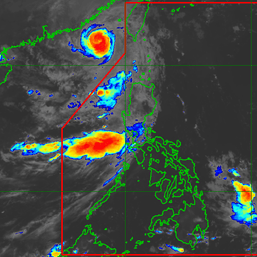
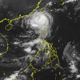
MANILA, Philippines – Tropical Storm Dodong (Talim) left the Philippine Area of Responsibility at 4 pm on Saturday, July 15, around two days after it developed inside PAR.
In a briefing past 5 pm on Saturday, the Philippine Atmospheric, Geophysical, and Astronomical Services Administration (PAGASA) said Dodong was slowly moving southeast, with its location still 305 kilometers west of Sinait, Ilocos Sur.
The tropical storm maintained its strength as it left PAR. It continues to have maximum sustained winds of 65 kilometers per hour and gustiness of up to 80 km/h.
PAGASA expects Dodong to intensify outside PAR and eventually become a typhoon by Monday, July 17.
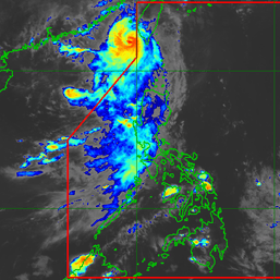
On Friday, July 14, Dodong made landfall in Dinapigue, Isabela, as a tropical depression. It then moved upward to Cagayan and crossed the northern part of mainland Northern Luzon, before leaving landmass via Ilocos Norte.
Signal No. 1 was the highest tropical cyclone wind signal raised due to Dodong. It also brought heavy rain to Northern Luzon.
Dodong was the Philippines’ fourth tropical cyclone for 2023 and the first for July. PAGASA earlier said two to four tropical cyclones may form inside or enter PAR within the month.

Although Dodong is already outside PAR, it will still enhance the southwest monsoon or habagat.
Frequent rain from the enhanced southwest monsoon is expected to persist in the Ilocos Region, Mimaropa, Zambales, and Bataan.
Occasional rain may again hit Metro Manila, Cavite, Batangas, Tarlac, Pampanga, Bulacan, and Western Visayas, while scattered rain showers and thunderstorms are possible in the rest of Luzon.
The rest of the Philippines will only have isolated rain showers or thunderstorms.
The enhanced southwest monsoon will also continue to bring gusts, or sudden and strong winds, to the following areas:
Saturday, July 15
- Ilocos Region, Cordillera Administrative Region, Batanes, eastern part of Isabela, Quirino, Nueva Vizcaya, Zambales, Bataan, Bulacan, Pampanga, Aurora, Metro Manila, Calabarzon, Mimaropa, Bicol, Western Visayas
Sunday, July 16
- Ilocos Region, Zambales, Bataan, Cavite, Mimaropa, Bicol, southern part of Quezon, Western Visayas
Monday, July 17
- Ilocos Region, Zambales, Bataan, Cavite, Oriental Mindoro, Palawan, Romblon, Antique
Meanwhile, PAGASA issued a new gale warning at 5 pm on Saturday for these seaboards:
- western seaboard of Luzon – rough to very rough seas, with waves 2.8 to 4.5 meters high
- northern seaboard of Northern Luzon, southern seaboard of Southern Luzon, western seaboard of Visayas – rough seas, with waves 2.8 to 4 meters high
The weather bureau advised small vessels not to sail and larger vessels to watch out for big waves. – Rappler.com
Add a comment
How does this make you feel?




There are no comments yet. Add your comment to start the conversation.