SUMMARY
This is AI generated summarization, which may have errors. For context, always refer to the full article.
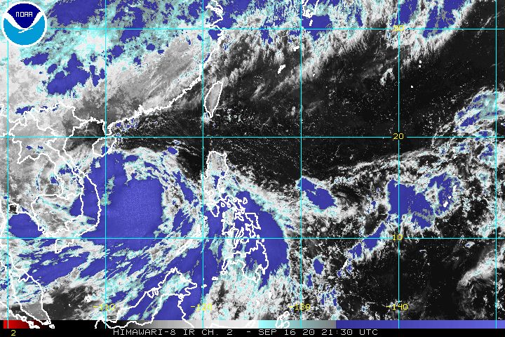
Tropical Storm Leon (Noul) left the Philippine Area of Responsibility (PAR) at 3 am on Thursday, September 17, but it will continue to enhance the southwest monsoon or hanging habagat.
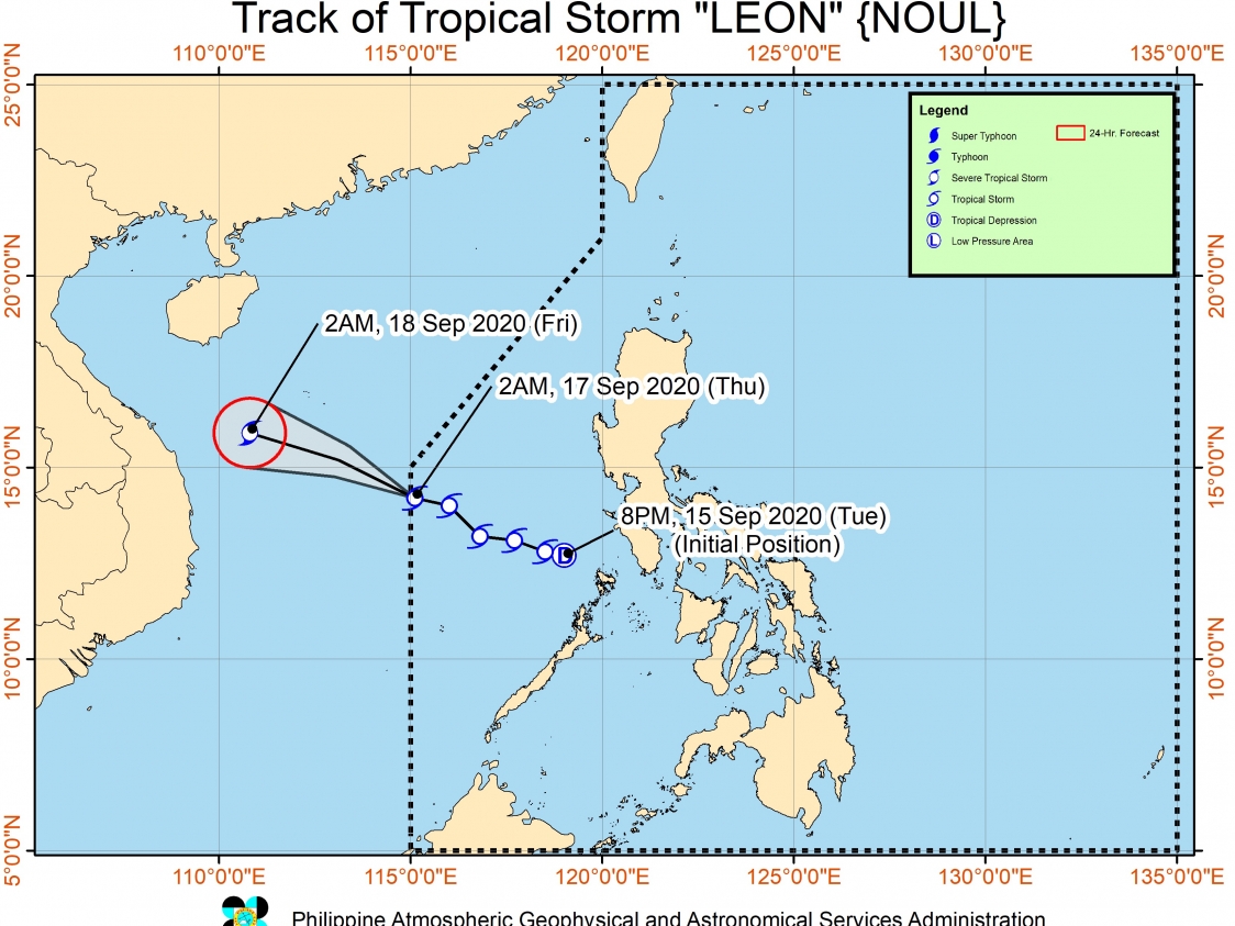
In a bulletin issued 5 am on Thursday, the Philippine Atmospheric, Geophysical, and Astronomical Services Administration (PAGASA) said Leon is now 360 kilometers north of the Kalayaan Islands in Palawan.
The tropical storm is moving west northwest at 15 kilometers per hour (km/h). PAGASA said it will then turn westward on Thursday night or on Friday morning, September 18, before making landfall in northern or central Vietnam on Friday afternoon or evening.
Leon did not hit land in the Philippines, though it did cross Southern Luzon when it was still a low pressure area.
Leon maintained its strength as it left PAR, with maximum winds of 85 km/h and gustiness of up to 105 km/h. But it is likely to reach severe tropical storm category within 12 hours and peak intensity on Friday. (READ: FAST FACTS: Tropical cyclones, rainfall advisories)
The southwest monsoon enhanced by Leon may bring intermittent gusts to these areas on Thursday:
- Batanes
- Babuyan Islands
- Mimaropa
- Western Visayas
Light to heavy rain, also from the enhanced southwest monsoon, may cause floods and landslides in the following areas:
- Mimaropa
- Bicol
- Aurora
- Quezon
- Visayas
- Caraga
A gale warning also remains in effect for the western seaboards of:
- Palawan, including Kalayaan Islands
- Occidental Mindoro
- Zambales
- Bataan
Travel is risky due to rough to very rough seas, with waves 2.8 to 4.5 meters high.
In the seaboards of the rest of the Philippines, moderate to rough seas are expected. PAGASA advised those with small vessels to watch out for waves 1.2 to 3.1 meters high.
Leon was the Philippines’ 12th tropical cyclone for 2020 and the 2nd for September.
An average of 20 tropical cyclones form within or enter PAR each year. Only around half of these make landfall. (READ: LIST: PAGASA’s names for tropical cyclones in 2020)
PAGASA gave the following estimates for the number of tropical cyclones inside PAR in the next 6 months:
- September 2020 – 2 or 3
- October 2020 – 2 or 3
- November 2020 – 1 or 2
- December 2020 – 1 or 2
- January 2021 – 1 or 2
- February 2021 – 0 or 1
PAGASA declared the start of the rainy season on June 12. – Rappler.com
Add a comment
How does this make you feel?


There are no comments yet. Add your comment to start the conversation.