SUMMARY
This is AI generated summarization, which may have errors. For context, always refer to the full article.
What’s the weather like in your area? Tweet us at @rapplerdotcom.
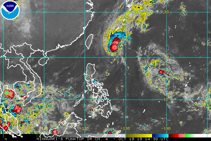
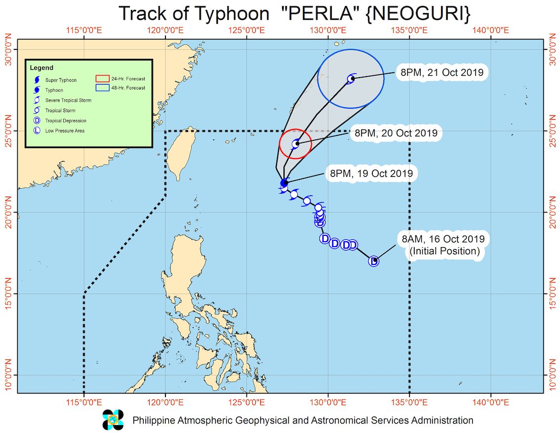
MANILA, Philippines – Perla (Neoguri) intensified from a severe tropical storm into a typhoon at 8 pm on Saturday, October 19.
In a briefing past 11 pm on Saturday, the Philippine Atmospheric, Geophysical, and Astronomical Services Administration (PAGASA) said Typhoon Perla now has maximum winds of 120 kilometers per hour (km/h) from the previous 100 km/h and gustiness of up to 150 km/h from the previous 125 km/h.
The typhoon is already 580 kilometers east northeast of Basco, Batanes. It decelerated and is slowly moving north.
Perla is not expected to make landfall in the country and there are no areas under tropical cyclone wind signals. PAGASA said no “significant high-impact weather” is expected. (READ: FAST FACTS: Tropical cyclones, rainfall advisories)
Based on Perla’s latest forecast track, it might leave the Philippine Area of Responsibility (PAR) between Sunday evening, October 20, and Monday morning, October 21.
Perla is the Philippines’ 16th tropical cyclone for 2019, and the 1st for October. (READ: LIST: PAGASA’s names for tropical cyclones in 2019)
The country gets an average of 20 tropical cyclones annually, but since 2019 is an El Niño year, only 14 to 18 tropical cyclones are expected.
Below is the estimated number of tropical cyclones from October to December:
- October – 2 or 3
- November – 1 or 2
- December – 0 or 1
PAGASA also continues to monitor a shallow low pressure area (SLPA) and a tropical cyclone which are both outside PAR.
The SLPA is now 1,830 kilometers east of Southern Luzon. It is moving west and could enter PAR on Monday or on Tuesday, October 22.
PAGASA Weather Specialist Ana Clauren said the SLPA only has a slim chance of becoming a tropical cyclone, though this possibility is not being ruled out.
It could also make landfall in Central Luzon or Southern Luzon in the coming days.
Meanwhile, the tropical cyclone outside PAR has since strengthened, becoming a tropical storm from a tropical depression on Saturday evening. It has been given the international name Bualoi.
Tropical Storm Bualoi is now 3,045 kilometers east of the Visayas, moving west at a slower 20 km/h from the previous 30 km/h.
Bualoi has maximum winds of 65 km/h from the previous 55 km/h and gustiness of up to 80 km/h from the previous 70 km/h. It might eventually become a typhoon in the next 2 to 3 days.
Bualoi might enter the northeastern portion of PAR in the coming days, but it might just stay near the boundary and not make landfall.
In the meantime, there may be occasional gusts in extreme Northern Luzon until early next week due to the northeasterly surface windflow.
The windflow may also continue to bring isolated light rain to these areas on Sunday:
- Batanes
- Ilocos Norte
- Apayao
- Cagayan
Also due to the windflow, travel remains risky in the seaboards of Northern Luzon, especially for small vessels.
The rest of the country will continue to have fair weather on Sunday, with just isolated rainshowers or localized thunderstorms.
PAGASA declared the start of the rainy season last June 14. – Rappler.com
Add a comment
How does this make you feel?
There are no comments yet. Add your comment to start the conversation.