SUMMARY
This is AI generated summarization, which may have errors. For context, always refer to the full article.

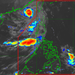
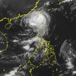
MANILA, Philippines – Tropical Depression Caloy left the Philippine Area of Responsibility (PAR) at 11 pm on Wednesday, June 29, but it will still enhance the southwest monsoon or hanging habagat.
The Philippine Atmospheric, Geophysical, and Astronomical Services Administration (PAGASA) said in a bulletin issued 5 am on Thursday, June 30, that Caloy was already 575 kilometers west of Iba, Zambales, slowly moving west outside PAR.
The tropical depression is expected to head northwest or west northwest over the West Philippine Sea from Friday to Saturday, July 1 to 2, PAGASA said.
Then Caloy could slowly move north northwest from Sunday to Monday, July 3 to 4, toward the southern part of China, where it is seen to make landfall.
In the early hours of Thursday, Caloy continued to have maximum sustained winds of 55 kilometers per hour and gustiness of up to 70 km/h.
The weather bureau expects Caloy to strengthen into a tropical storm within 24 hours and reach a peak intensity of around 75 km/h by Friday evening or Saturday.
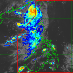
Caloy did not make landfall in the Philippines and no tropical cyclone wind signals were raised due to the tropical depression. But it has been enhancing the southwest monsoon, which will bring more rain on Thursday.
Monsoon rain is expected in these areas:
- Bataan
- Zambales
- Palawan
- Oriental Mindoro
- Occidental Mindoro
- Aurora
- Quezon
Scattered rain and thunderstorms may also hit the rest of Luzon, including Metro Manila, and Western Visayas.
In Metro Manila, where president-elect Ferdinand Marcos Jr. will take his oath, PAGASA Weather Specialist Benison Estareja said skies will be cloudy in the morning, followed by a bit of sun around noontime. But from early afternoon to evening, the chances of localized thunderstorms are high.
Periods of moderate to heavy rain can cause flash floods or landslides.
Occasionally gusty conditions will persist in extreme Northern Luzon as well as the western parts of Luzon and the Visayas due to the enhanced southwest monsoon.
PAGASA also again warned of moderate to rough seas in the seaboards of Northern Luzon and the western seaboards of Central Luzon and Southern Luzon. Waves will be 1.5 to 4 meters high, which may be risky for small vessels.

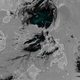
Meanwhile, the low pressure area (LPA) that formed inside PAR on Wednesday was last spotted 1,020 kilometers east of Northern Luzon early Thursday.
Estareja said the LPA is likely to develop into a tropical depression in the next 48 hours. It would be given the local name Domeng if it becomes a tropical depression, and would be the fourth tropical cyclone for 2022.
Here are PAGASA’s estimates for tropical cyclones in the next six months:
- July – 2 or 3
- August – 2 or 3
- September – 2 or 3
- October – 2 to 4
- November – 2 or 3
- December – 1 or 2
– Rappler.com
Add a comment
How does this make you feel?




There are no comments yet. Add your comment to start the conversation.