SUMMARY
This is AI generated summarization, which may have errors. For context, always refer to the full article.
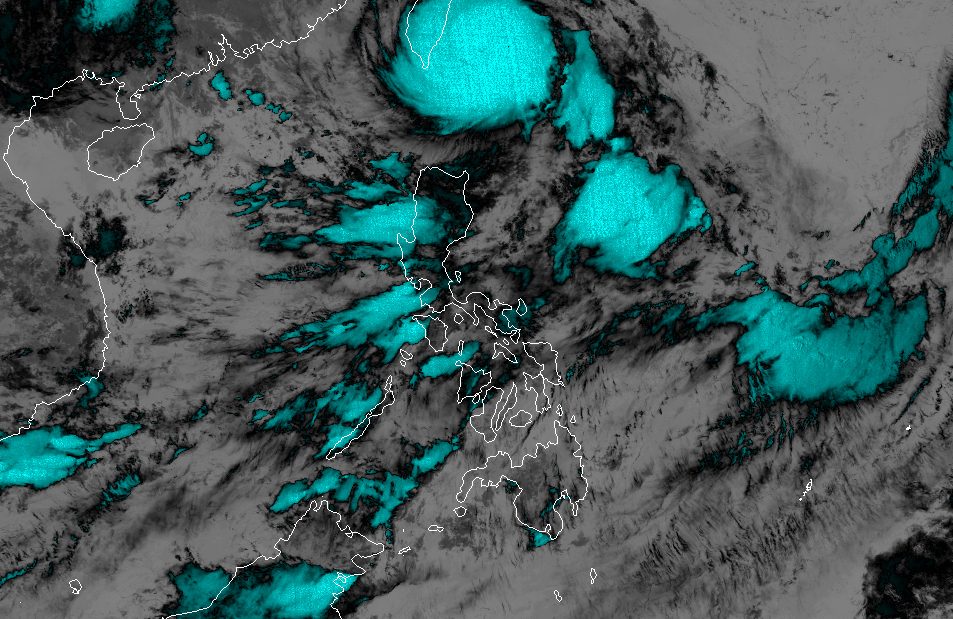
MANILA, Philippines – Typhoon Hanna (Haikui) slightly intensified early Sunday, September 3, while moving closer to the coast of southern Taiwan.
Taiwan is within the Philippine Area of Responsibility (PAR).
In a briefing past 5 am on Sunday, the Philippine Atmospheric, Geophysical, and Astronomical Services Administration (PAGASA) said Hanna was located 215 kilometers north northeast of Itbayat, Batanes.
The typhoon is moving west, maintaining a speed of 20 kilometers per hour (km/h).
Its maximum sustained winds increased from 140 km/h to 150 km/h, while its gustiness is now up to 185 km/h from the previous 170 km/h.
As of 5 am on Sunday, Batanes remains under Signal No. 1. Also placed under Signal No. 1 was the northern part of Babuyan Islands, specifically Babuyan Island and Calayan Island. These areas face strong winds from Hanna.
Batanes will also see moderate to heavy rain from the typhoon on Sunday, even though it will not make landfall in the Philippines.
PAGASA expects Hanna to make landfall “at or near peak intensity” along the east coast of southern Taiwan on Sunday afternoon or evening.
“Slight intensification shortly before landfall is not ruled out, although this window is quickly closing as the typhoon moves closer to land,” added the weather bureau.
Hanna will “cross the rugged terrain of southern Taiwan” on Sunday evening, “resulting in considerable weakening.”
Then it may emerge over the Taiwan Strait and leave PAR late Sunday evening or early Monday morning, September 4, as a severe tropical storm.
Outside PAR, it may slow down over the Taiwan Strait, and also weaken further.
PAGASA said Hanna could make its final landfall along the coast of Guangdong or Fujian in China on Tuesday, September 5, as a tropical storm. By late Wednesday, September 6, or Thursday, September 7, it could weaken into a remnant low.

Hanna also continues to enhance the southwest monsoon or habagat, which will still trigger rain in the western part of Luzon as well as the province of Antique. Floods and landslides remain possible.
Saturday night, September 2, to Sunday night, September 3
- 100-200 millimeters (mm): Ilocos Region, Zambales, Bataan, Occidental Mindoro
- 50-100 mm: Metro Manila, Abra, Benguet, Tarlac, Nueva Ecija, Pampanga, Bulacan, Rizal, Cavite, Batangas
Sunday night, September 3, to Monday night, September 4
- 100-200 mm: Ilocos Region, Zambales, Bataan, Occidental Mindoro
- 50-100 mm: Metro Manila, Abra, Benguet, Tarlac, Nueva Ecija, Pampanga, Bulacan, Rizal, Cavite, Batangas, northern part of Palawan including Cuyo and Calamian islands, Antique
Monday night, September 4, to Tuesday night, September 5
- 100-200 mm: Zambales, Bataan
- 50-100 mm: Metro Manila, Ilocos Region, Abra, Benguet, Tarlac, Nueva Ecija, Pampanga, Bulacan, Rizal, Cavite, Batangas, Occidental Mindoro, northern part of Palawan including Cuyo and Calamian islands, Antique
Gusty conditions will also persist in these areas due to the enhanced southwest monsoon:
Sunday, September 3
- Babuyan Islands, Ilocos Region, Cordillera Administrative Region, Nueva Vizcaya, Zambales, Pampanga, Bataan, Aurora, Bulacan, Metro Manila, Calabarzon, Mimaropa, Bicol, Western Visayas, northern part of Eastern Visayas
Monday, September 4
- Batanes, Babuyan Islands, Ilocos Region, Abra, Benguet, Apayao, Nueva Vizcaya, Zambales, Pampanga, Bataan, Aurora, Bulacan, Metro Manila, Calabarzon, most of Mimaropa, most of Bicol, most of Western Visayas
Tuesday, September 5
- Batanes, Babuyan Islands, Ilocos Region, Zambales, Bataan, Cavite, northern part of Quezon, Lubang Island, Romblon, Kalayaan Islands
ALSO ON RAPPLER
- Clarkson on fire as Gilas Pilipinas trips China for first FIBA World Cup win in nearly a decade
- ‘On everybody’s radar’: Japan locks up Asian Olympic spot
- ‘On cloud nine’: FIBA World Cup debutant South Sudan punches Olympic ticket
- Canada coach blasts star-studded crew after shock loss to Brazil
- IN PHOTOS: Maria Ressa pays tribute to Amal Clooney in DVF Awards 2023
Meanwhile, PAGASA released a new gale warning at 5 am on Sunday, still due to Hanna and the enhanced southwest monsoon. These seaboards are covered by the gale warning:
- northern seaboard of Northern Luzon (Batanes, Babuyan Islands) – rough to very rough waters, waves 2.8 to 5 meters high
- western seaboard of Luzon (Ilocos Norte, Ilocos Sur, La Union, Pangasinan, Zambales, Bataan, Occidental Mindoro including Lubang Island) – rough to very rough waters, waves 2.8 to 4.5 meters high
- northern seaboard of Northern Luzon and western seaboard of Southern Luzon (Metro Manila, Cavite, Batangas) – rough to very rough waters, waves 2.8 to 4.5 meters high
- eastern seaboard of Northern Luzon and western seaboard of Southern Luzon (Cagayan, Isabela, northern part of Palawan including Calamian, Cuyo, and Kalayaan Islands) – rough to very rough waters, waves 2.8 to 4.5 meters high
- eastern seaboard of Central Luzon, eastern and southern seaboards of Southern Luzon, and western seaboard of Visayas (Aurora, northern Quezon, Oriental Mindoro, Marinduque, Romblon, Antique, Aklan) – rough waters, waves 2.8 to 4 meters high
The weather bureau advised fishing boats and other small vessels not to sail, and larger vessels to watch out for big waves.
Hanna is the Philippines’ eighth tropical cyclone for 2023.
For the next 6 months, PAGASA estimated that 6 to 9 tropical cyclones may form within or enter PAR:
- September 2023 – 2 or 3
- October 2023 – 2 or 3
- November 2023 – 1 or 2
- December 2023 – 1 or 2
- January 2024 – 0 or 1
- February 2024 – 0 or 1
– Rappler.com
Add a comment
How does this make you feel?


There are no comments yet. Add your comment to start the conversation.