SUMMARY
This is AI generated summarization, which may have errors. For context, always refer to the full article.
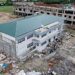
![[ANALYSIS] June 15’s magnitude 6.3 deep-focus Calatagan earthquake](https://www.rappler.com/tachyon/2023/06/tl-calatagan-earthquake.jpg)
At 10:19 this morning, I just settled parking when the car started shaking slightly sideways. As I looked around to check if somebody was leaning on the fenders to check the source of the shaking – I found no one – I received an earthquake alert on my mobile phone within about 3 to 4 seconds into the shaking. In the next 20 seconds or so, the car shook more vigorously, then waned a few more seconds later – intensity IV, I thought.
While still in the car, an immediate check at the earthquake app that locates recent tremors detected by citizen scientists that maintain seismometers connected to the University of the Philippines (UP) Diliman seismic network reported a magnitude 6.2 earthquake with the epicenter plotting off the east coast of Calatagan Peninsula in Balayan Bay, Batangas. The Philippine Institute of Volcanology and Seismology (Phivolcs) posted in its earthquake bulletin an offshore epicentral location to the southwest of the peninsula, magnitude 6.3, and felt intensity of IV in Quezon City.
Depth is significant
Posts on social media immediately followed, showing photos and videos of occupants evacuating high-rise buildings as well as shaking experienced along elevated highways captured by CCTV. Fortunately, there have been no reports of infrastructure damage (at least, none yet), although Phivolcs warned of potential damage to infrastructure and the possibility of aftershocks.
On April 22, 2019, a magnitude 6.1 earthquake – which was weaker by almost three times in energy released than the earthquake today at magnitude 6.3 – struck the provinces of Bataan, Zambales, and Pampanga and caused extensive damage to infrastructure, including collapsed commercial establishments, fallen church facades, damaged residential buildings due to liquefaction, and earthquake-induced landslides on the southern mountain slopes of Mt. Pinatubo.
Similarly, on February 15, 2003, an earthquake of the same magnitude 6.3 struck the island of Masbate in the central Philippines and caused significant infrastructure damage and ground deformation, including a surface ground rupture that left a coconut tree sliced into two about its axis. Interestingly, this same coconut tree was sliced anew after 17 years by the same fault during the magnitude 6.6 Masbate earthquake of August 18, 2020, which is quite a rarity in earthquake dynamics.
So why is there no infrastructure damage in Batangas, similar to what has been experienced in Zambales in 2019 and in Masbate in 2003?
The Batangas earthquake was generated by the rupturing of a fault located more than 100 kilometers deep into the asthenosphere, while the Zambales and Masbate earthquakes were generated by a fault source located at much shallower depths (less than 30 kilometers) within the crust. Two earthquakes of the same magnitude can cause varying degrees of damage to infrastructure. A deep focal source is expected to inflict less damage than a shallow one because the energy released at the source dissipates (loses strength) as it travels over distance.
Why is Batangas frequented by earthquakes? Where else?
Initial earthquake modeling by my graduate student Sandra using the concept of stress transfer indicates that today’s earthquake was likely generated by the same fault system that generated the sequence of earthquakes that struck the same area in the latter half of 2021. From July 24 to December 13, 2021, the offshore area to the southwest of Batangas was struck by at least six earthquakes with magnitudes ranging from 5.2 to 6.6. This area is prone to earthquakes because of the presence of the Manila Trench, a tectonic feature that marks the subduction of the South China Sea plate underneath Luzon.
In subduction, a slab of crust slides underneath another. The interaction between the two slabs initiates movements along faults that eventually generate earthquakes. Fortunately for today’s earthquake, the seismic waves originated from a deep source, thus the minimal to nil report on damage to infrastructure.
In the Philippines, there are six subduction trenches that are capable of generating earthquakes of similar or even greater magnitudes. Surrounding the entire archipelago with the exception of Palawan Island, these trenches are found west of Luzon (Manila Trench), west of Negros Island (Negros Trench), west of Zamboanga Peninsula (Sulu Trench), west of Mindanao (Cotabato Trench), east of Bicol to Mindanao (Philippine Trench), and east of Luzon (East Luzon Trough).

Earthquake drills paying off
Today’s earthquake disrupted school activities, including the exams taken by my class of graduating geology students, who obediently followed protocol in emergency evacuation. Other classes – some also taking exams (today is UP Diliman’s last day of classes for school year 2022-23) – and other offices and research laboratories were likewise interrupted. But because our institute participated in the National Earthquake Simultaneous Drill exercise held on June 8, 2023, the evacuation of the UP National Institute of Geological Sciences was carried out smoothly and successfully.
We hear from other sources that evacuation procedures in other parts of the metropolis and nearby provinces also were carried out successfully. This is a good indication that the simulated earthquake drills are paying off and will hopefully lead to a culture of earthquake resilience, where safety consciousness will become second nature to all Filipinos. – Rappler.com
The author, Mario A. Aurelio, PhD, is a professor at the University of the Philippines‘ National Institute of Geological Sciences (UP NIGS), interested in the study of earthquakes. He is listed in the 2023 Asian Scientist 100, together with 13 other Filipino scientists. Sandra Catugas is a master’s student at UP NIGS under the tutelage of Aurelio.
Add a comment
How does this make you feel?


There are no comments yet. Add your comment to start the conversation.